



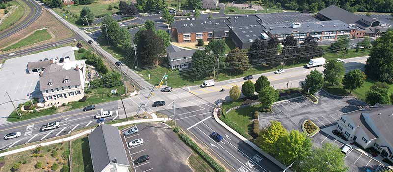
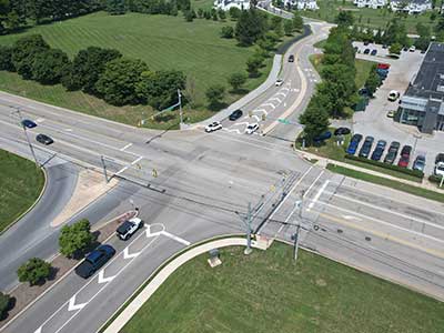
The Waterloo Boulevard extension in Exton has improved the area's road connectivity.
How it Works
A high degree of connectivity means there are many ways to get from Point A to Point B. An inter-connected roadway network can accommodate more travel demand than a roadway network with limited connectivity.
The traditional grid-style or modified-grid street layout provides excellent connectivity because streets are interlinked at numerous points, intersections are closely spaced, and there are few dead-ends. The presence of a grid pattern and alternate parallel streets allows the state highway and other major roads to serve their main purpose — moving vehicles over longer distances — while shorter trips can take place on local streets. However, suburban municipalities with individual, isolated cul-de-sac developments typically require access onto arterial streets, and often inhibit walking and bicycling by both adults and children. These suburban developments create congestion by overloading the limited number of intersections within the network. Typically, the best solution is to provide for a balance of increased connectivity with a few opportunities for cul-de-sacs or dead-end streets where appropriate, and the use of traffic calming measures for reducing speeds and improving safety.
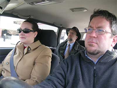
Interconnected streets make it easier for those using passenger vehicles, walking, or biking to reach their destinations.
Benefits
Energy Conservation
More direct travel routes and faster travel can reduce fuel use, and pollution can be reduced because of faster travel times.
Safety
Increased roadway connectivity can result in a safer system for vehicles, pedestrians, and bicyclists.
Reduced Congestion
Decreased traffic at bottlenecks can result from increased roadway connectivity.
Travel Efficiency
More roadway connectivity can result in continuous and more direct routes, which also benefits service or delivery vehicles.
Better Emergency Service Response
Improved emergency vehicle access and faster response times can result if emergency vehicles have more access options.
Increased Walking and Biking
More roadway connectivity can result in increased opportunities for walking and biking, thus increasing physical activity, as well as more efficient transit and school bus transportation.
Improved Vehicle Distribution
More roadway connectivity can result in better distribution of vehicular traffic across the system.
Increased Utility Efficiency
More roadway connectivity can result in improved utility connections, easier maintenance, and more efficient trash collection.
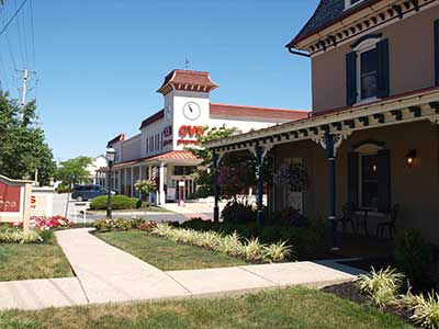
With the addition of new roads, Upper Uwchlan Township has created a modified grid street pattern in Eagle Village.
Get Started
Road connectivity is a fundamental element of a community's transportation planning efforts.
Considerations
Changed Traffic Patterns on Residential Streets
More roadway connectivity can result in increased traffic on some residential streets and less than others, spreading out the traffic more than it would have been if all traffic were funneled to one point. For those properties fronting roads that receive more traffic, this can be controversial. Generally, with more interconnectivity, all residents of a development will have more and better options for reaching their destinations.
Potential for Cut-Through Traffic
Interconnections must be designed well to discourage any cut-through traffic in residential neighborhoods.
Cost
Providing more connections can result in increased local infrastructure costs at the time of development and increased impervious cover; however, costs of governmental services, such as trash collection or mail delivery, should go down slightly due to more efficient routing.
Safety
Generally, because emergency vehicles can more easily access interconnected developments and because residents have more options of leaving in the case of an emergency, interconnected roadways are safer. However, less congestion can result in increased vehicle speeds, which should be calmed with various traffic control measures.
Local Opposition
Many residents prefer cul-de-sacs instead of connected streets and will oppose interconnections despite the broader benefits these connections bring to the community as a whole.
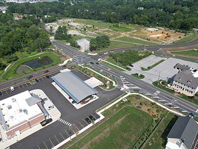
The Ship Road Couplet in West Whiteland Township has improved road connectivity near the intersection of Ship Road and Lincoln Highway.
Planning
Roadway connectivity should be woven into all planning efforts of a community, whether that community is urban, suburban, or rural.
Comprehensive and Transportation Plans
Comprehensive plans and transportation plans should identify road interconnectivity as a goal or objective. Specific proposed connections should be identified and shown on a map.
Official Map
Communities can use the Official Map to show proposed roadway connections and new roads, thereby preserving these rights-of-way for a year when subdivisions and land developments are proposed.
Subdivision and Land Development Ordinance
Most subdivision and land development ordinances require new developments to continue existing or platted streets and to provide street connections to abutting undeveloped properties. To support roadway connectivity, these requirements should not be waived.
Zoning Ordinance
Sometimes, street connectivity requirements are built into specific zoning districts, usually higher-density mixed use districts, particularly those on larger lots.
Plan Approval
During the plan review process, communities should work with developers to ensure that street connectivity requirements are met. Waiving of these requirements should only be done when interconnectivity is not possible due to physical constraints like steep slopes, floodplains, etc.
Examples
The following connectivity examples within Chester County municipalities are illustrated through a combination of historical aerial photos and planning documents.
Caln Township
G.O. Carlson Boulevard is planned to be an arterial collector street that runs parallel to the north and provides congestion relief from the heavily traveled Business Route 30. This roadway has been developed incrementally over time and will achieve full buildout with the completion of the final segment between Park Drive and Hidden Creek Drive. This continuous roadway is envisioned with the Future Transportation Plan element of the Caln Township's Comprehensive Plan.
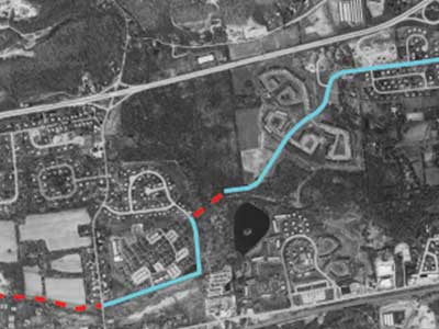
Aerial photo from 1990; the Route 30 By-Pass is to the north, and Business 30 is to the south.
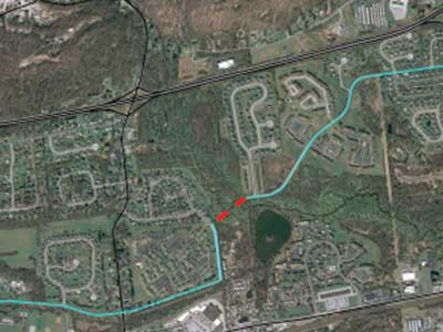
Aerial photo from 2010, showing the proposed alignment of G.O. Carlson Boulevard.
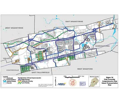
The Future Transportation Plan from Caln Township's Comprehensive Plan.
East Caln Township
East Caln Township officials utilized the Official Map for the development of Bell Tavern Road.
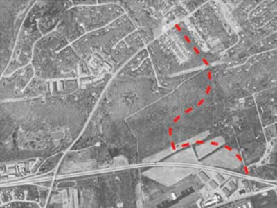
Aerial photo from 1980.
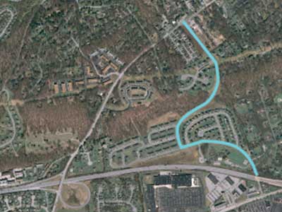
This aerial from 2010 shows Bell Tavern Road.
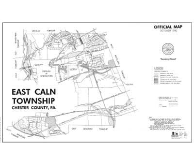
Official Map of East Caln Township.
Lionville
Uwchlan Township developed various roadway connections in the vicinity of the PA 100/PA 113 intersection as part of a Master Plan/Land Development Process.
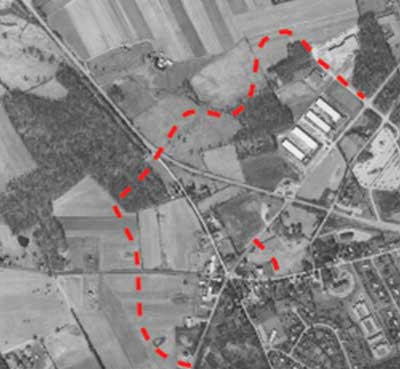
Aerial photo from 1985.
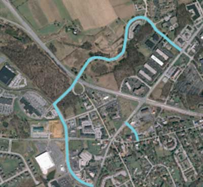
This 2010 aerial photo shows the PA 100/PA 113 intersection improvements.
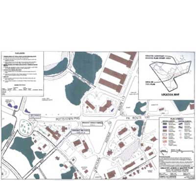
Greater Lionville Master Plan.
Tredyffrin Township
Tredyffrin Township's subdivision and land development ordinance contains the following language in section 181-46.A(4):
Residential streets shall be laid out so as to discourage through traffic; however, the arrangement of streets shall provide for the continuation of existing or platted streets and shall provide proper access to adjoining undeveloped tracts suitable for future development.
West Whiteland Township
Commerce Drive in Exton was developed to provide connectivity around the PA 100 and Business Route 30 intersection.
West Chester Borough
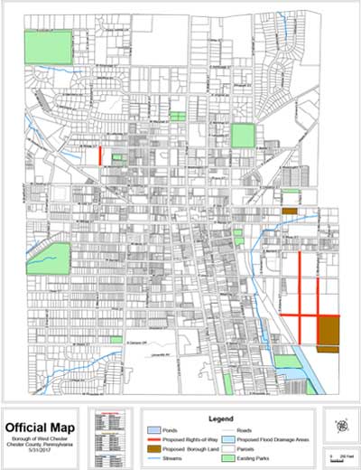
The West Chester Borough Official Map shows the continuation of Penn Street and Worthington Street through the Wyeth property, which maintains the grid layout.
West Grove Borough
West Grove has zoning ordinances for its C-1 Town Center District, including:
§400-39 Purpose
§400-39.F. Create an interconnected network of streets to effectively accommodate vehicle, pedestrian, and bicycle circulation and to create a block structure achieving connectivity to adjacent zoning districts.
§400-42 Design Standards
§400.42.F. Blocks. Blocks in the C-1 District shall have a minimum length of 200 feet and a maximum length of 500 feet.